Navigis River has been the standard for inland navigation for many years. The reason for this is the simplicity and user-friendliness of its sophisticated navigation technology.
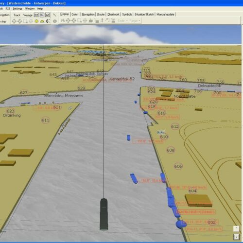
The vessel’s GPS position is displayed on a navigational chart. While the vessel remains in a fixed position, the chart moves under the vessel, similar to a radar image. You can see everything you need for navigation with just a simple mouse click. Other data such as your course, speed, and VHF channels are shown in separate windows, giving you extra assistance to ensure smoother and safer navigation.
With its many optional extras, Navigis can be upgraded from a navigation programme to an all-inclusive navigation manager to include itineraries, voyage reporting, eMessaging, etc.

